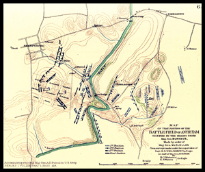
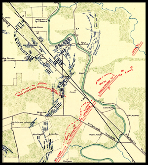
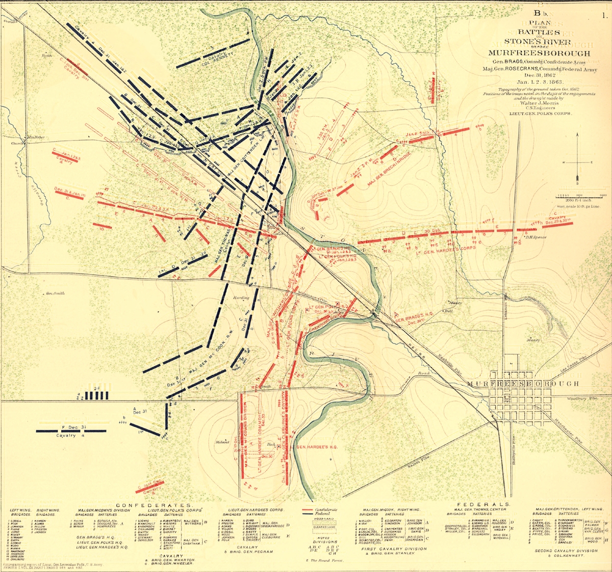
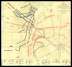
Atlas of the War of the Rebellion. Originally published in 1891-1895, the collection contains 821 maps, 106 engravings, and 209 drawings. In 1978 Fairfax Press republished the Atlas in a very heavy book that weighed about eight pounds and renamed it The Official Military Atlas of the Civil War.
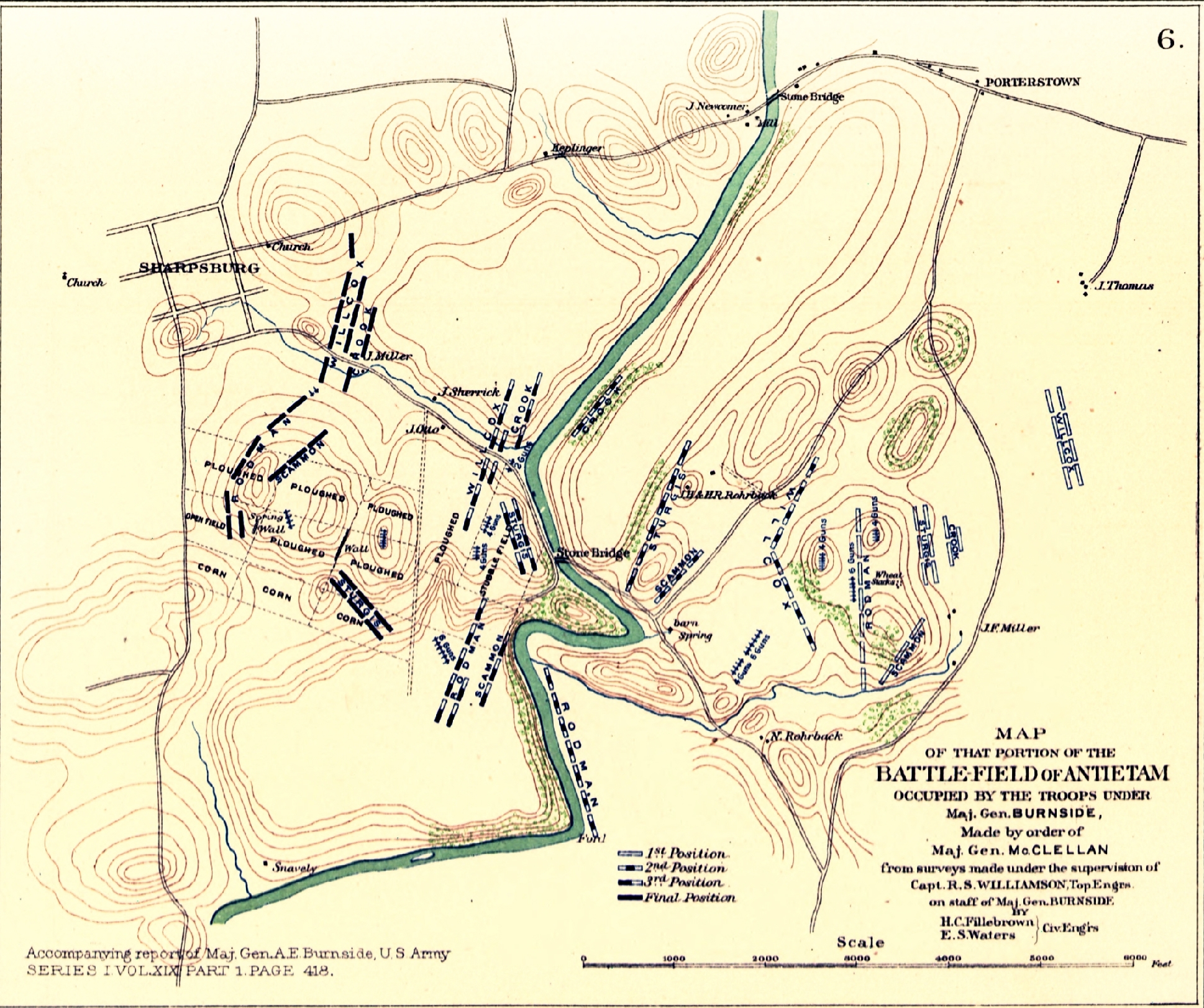
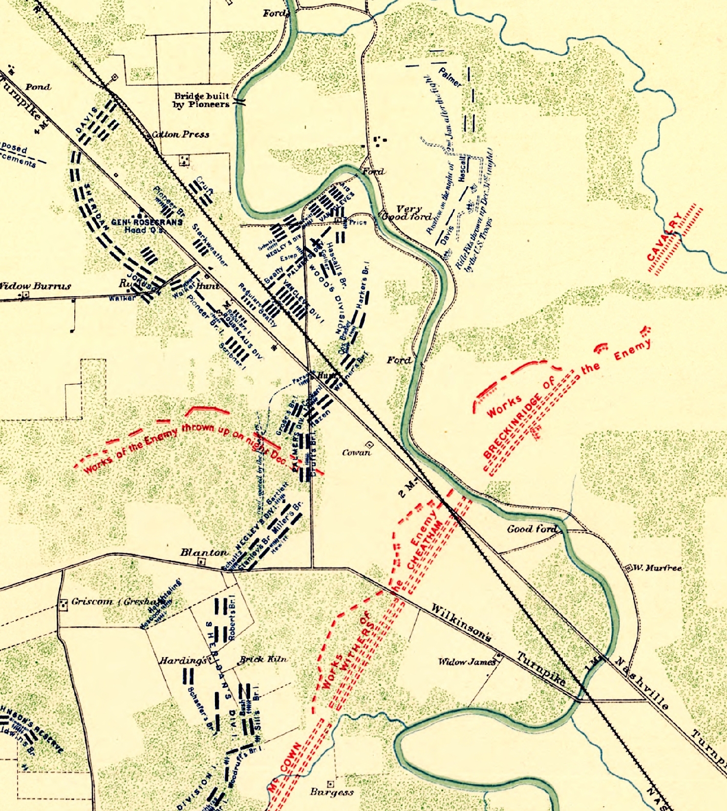
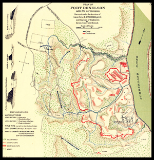
The maps were drawn both during and after the Civil War by Union and Confederate engineers, draftsmen, and aided often by the generals themselves. Cartographers later added to the collection to fill voids in the absence of maps accompanying battle reports. The maps are quite detailed, showing troops positions, defense lines, redoubts, fortifications, signal stations, lines of march, landmarks, and topography. Some are still shown as rough sketches, while others are cartographic masterpieces. A plate index is provided to facilitate in locating the maps, and all are available in jpeg high resolution 300 dpi. The entire collection is in public domain and can be copied, published, framed, or retained for research.
Atlas of the War of the Rebellion on 8gb USB Drive 24.95
Exceptional Content...Legendary Service


Compilations and Designs
© 2026 Civil War Digital

NEW...The Red River Campaign
NEW...Official Records Sale !!